By THAN HTUN (GEOSCIENCE MYANMAR)
EPISODE:41
Mergui Series
This article is a continuation of Episode 40, entitled ‘The Geology of the Mergui District,’ written by GSI geologist Sethu Rama Rau in 1930.
Laterite
The lateritic rocks of the district are classed according to their origin.
I. Those derived from rocks in situ.
II. Those derived from the lateralization of recent argillaceous alluvium and of detrital origin.
The olivine basalt of Medaw Island is covered with a thin mantle of laterite, which is formed by the alteration of the mineral constituents of basalt. The coastline fringing the mainland from Mathe to Salangin, east of the Turret Islands, exposes large blocks of lateritic boulders. These boulders are formed from the weathering and disintegration of sedimentary rocks of the Mergui Series, and the laterite is of vesicular variety. The quartzites and slates of the Mergui Series have pyrites as one of their constituents, and the alteration and subsequent hydration of this produced limonite for the lateralization of the argillaceous remnants left during the process of weathering. Laterite formed by the weathering of granite occurs on many of the islands such as Pulo Baleigh, etc.
On the northern coast of Kalagyun Island and on the east coast of the islands situated east of King Island, there are laterites derived from the weathering and alteration of rocks in situ. Many instances of laterite-covered islands might be cited in the southern part of the Archipelago, where the process of lateralization is still in progress.
Alluvium
The older alluvium is restricted to the larger valleys, such as those of the Tenasserim, the Lenya, and the Pakchan Rivers. It consists of beds of ferruginous sandstones and conglomerates, gravel, and pale white clays. Some of the beds bordering the Tenasserim River consist of impure kaolin transported by streams flowing from the slopes of granite ridges. The thickness of the older alluvium ranges up to sixty feet, and the beds are sometimes gently inclined, in contrast to the newer alluvium, which is always horizontal. Areas suitable for dredging tin are usually situated on the older alluvium.
The recent or newer alluvium occurs in all the river’s valleys and on the present sea coast and includes the coastal marine sediments and estuary deposits transported by the tides. This alluvium consists of alternate layers of sand and beds of fine silt. In the upper courses of the rivers, such as the Bokpyin, the Palaw, the Pakchan, and the Palauk are found alternate beds of gravel and sand, while in the lower parts near the mouths, which are subject to tidal action, the deposits consist primarily of fine silt with thin layers of sand. The flat plains on the banks of rivers are generally cultivated with paddy. On the sea coast, the disintegration products of both the sedimentary and granite rocks are washed to and fro by tides, and the soluble matter is removed in solution, leaving sand banks and layers of mud in the lagoons and littoral flats. A figure of the report gives an idea of marine denudation and the deposition of beds of sand on the banks of a tidal creek.
Tectonics
The geological formations of Lower Burma, especially of the South Tenasserim division, consisting of the districts of Tavoy and Mergui, appear to have been disturbed by crustal movements during several periods. The base on which the sediments of the Mergui series were deposited is nowhere exposed. It has been observed, in the section on the Mergui formation, that these strata are folded into narrow, closely compressed corrugations. This folding took place at the close of the deposition of the Mergui series. The folding of the Mergui series is sharper and more intense than that of the Moulmein limestone, in which it is of a comparatively gentle type. It is quite possible that the first folding preceded the deposition of the Moulmein series and that after this folding, the whole country was submerged under the ocean during the deposition of the sediments forming the limestones, as the latter contains marine fossils (ascribed to the Carboniferous period). There followed an upheaval by crustal movements, which folded the rocks of the Moulmein and Mergui series. These movements caused folds where axes are parallel to the strike of the sedimentary rocks and produced lines of weakness through which the acid igneous rocks have intruded. The granite range of the Mergui district, extending from the Myinmoletkat Taung to Victoria Point, is representative of the acid igneous intrusive. As the sediments formed from the disintegration and denudation of these granites are deposited in beds of the Red Sandstone series, which are probably of Jurassic age, the second series of crustal movements may have taken place during the interval between the Carboniferous and the Jurassic periods.
Igneous Intrusive
The granites are intrusive into sedimentary strata of unfossiliferous argillites and slates and are exposed in a series of bosses, which can be grouped into three distinct ranges.
Granite
1. The easterly range forming the political boundary between British territory and Siam, named the ‘Frontier Range’ of the district of Tavoy, with which it is continuous, divides the drainage of the Tenasserim valley on the west from that of the rivers flowing into the Gulf of Siam in Siamese territory on the east. This range is contiguous with the easterly spur of the Myinmoletkat Taung, which rises to a height of 6,800 feet above sea level. On the east of the Tenasserim River, the easterly range takes a south-south-easterly trend. It is accessible at the source of the Theinkun Chaung, one of the tributaries of the little Tenasserim River. The hills from which the Klong Thampra rises are a continuation of this range. Further south, the easterly range can be traced to the Siamese territory east of Pakchan Village and Ra- Nohng.
II. The central chain, which is almost parallel to the coast, comprises disconnected bosses of granite surrounded by argillites and forms the southerly continuation of the Myintha intrusion exposed along the Pe Chaung of the Tavoy district. The northernmost spur of this range is the Myinmoletkat Taung near the source of the Palauk Chaung. The following are some of the granite peaks which, though appearing disconnected at the surface, may be taken to represent summits on a continuous subterranean range: Wazwinok, Gyinni, Mino, Tamok, Sandawut, Wabyauk, Cheyadaw, Yanngwa, Karathuri, and Maliwun. Almost all successful tin and wolfram mines of the district are situated on the slopes of these hills and adjoining country, through which run quartz and pegmatite veins.
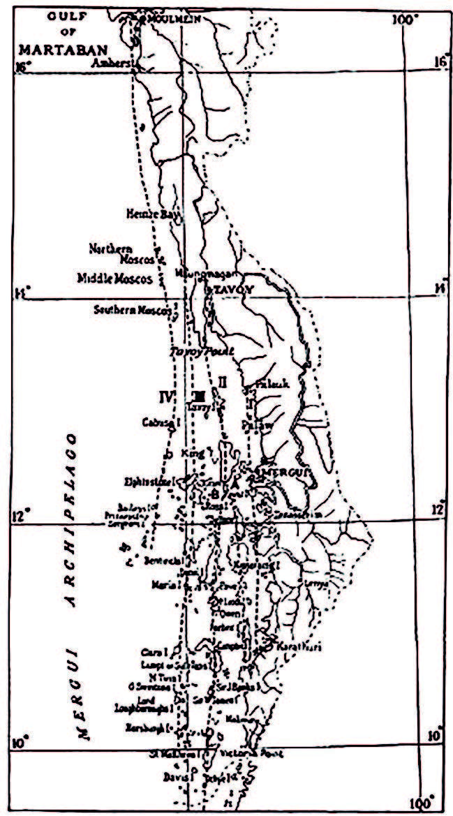
III. The westerly range, which is a continuation of the ‘Coastal Range’ of the Tavoy district, passes southwards through Great and Little Canister islands and then bifurcates. Elphinstone, Grant, and Ross Islands represent the western, while King, Mergui, Sellore, Parkers, Money, Domel, Sai Kum, and High Islands are from the southerly continuation of the eastern branch. The granite of this range is not of much economic importance.
Further west, there is another line of islands consisting of granite, whilst the islands of the southern Moscos off the coast of Tavoy and visible from Maungmakan are also of the same rock. This chain may be continued south through Cabusa, Prinseps, and Sergeant islands to the group of the Great Western Torres Islands. Mr J J A Page examined some of these islands during his traverses.
Granite containing muscovite mica and tourmaline is the most probable source of tin and wolfram ores. The hornblendic variety of granite is in great disfavour with the prospector, whilst the biotite variety is still less favoured than the hornblende variety. Tourmaline granite with muscovite, either in the form of isolated bosses or as pegmatites, is the most promising rock for tine ore in the Mergui district.
Age of granite
It is difficult to fix the age of the granite. The conglomerates of Patit Island, forming a part of the ‘Red Sandstone Series’ consist of grains of felspar, quartz, and granite pebbles derived from the granite. Hence, the granites should have been intruded before the deposition of the sediments of the Red Sandstone Series, which have been ascribed to the Jurassic age by lithological comparison with similar rocks elsewhere. The author is, therefore, inclined to think that the granitic intrusions may have taken place before the Jurassic period.
Quartz veins
Quartz veins have been formed in both granite and sedimentary rocks by the filling of fissures caused by the cooling of the plutonic magma. Most of the quartz veins formed in this manner are intrusive into the granite at the margins and traverse the sedimentaries adjoining it, indicating a late phase of igneous action. In some of the tin mining areas, they are not associated with a visible boss of granite but are found with aplite and pegmatite dykes. In the islands of the Archipelago, some veins run along the joint and cleavage planes and are not connected with any outcrop of granite or pegmatite.
Greisen
Greisen occurs chiefly at the junction of the granite with the sedimentary rocks on the walls of ore-bearing quartz veins or as narrow segregated bands in the granite. It is composed of mica, chiefly muscovite and quartz, with minimal quantities of felspar. In many cases, felspar is absent. The mines of the Maliwan, Tagu and Palauk areas expose many such bands at the junction of the granite with the sedimentary series. This rock, being usually rich in tin and wolfram ores, is carefully looked for by the prospector as it gives rich concentrates on sluicing. Tourmaline is generally associated with the ores of tin in greisen.
Pegmatite
Pegmatites generally occur as veins and as lenticular patches of a small extent but do not form continuous bosses like granite. They may be either of the same age as the granite or of later origin but intruded into the surrounding sedimentary rocks during the cooling of the granite. Their outcrops are disconnected and appear as lenticular masses. However, they keep regularity in their direction, which coincides with the strike of the sedimentary rocks - about 10° W of N – and they must have emanated from the same magma as the granite.
The chief mineral constituents of the pegmatites are quartz, orthoclase felspar, and muscovite, with the accessory minerals of tourmaline, garnet, cassiterite, muscovite, and oxides of iron. Tin ores are either poor or absent in pegmatites containing tourmaline without muscovite, while the rock in which muscovite is abundant is generally rich in cassiterite. Weathered pegmatite veins and the residual and detrital deposits derived from them are the chief sources of the district’s tin ores. The tin mines of Klong Banhuni, Klong Nam Noi Pre-sai, and many others are situated close to pegmatite outcrops. Quartz veins traverse the pegmatites and the granite and may represent the last phase of the magma.
Quartz porphyry
Quartz porphyry, which occurs mostly on the sea coast, is situated at the margins of granite and is exposed by the removal of the overlying soil. The chief exposures are on the islands of the Hin Pota, Pase Mira (Hakadin), and Ban Sadein near the mouth of the Talobusa chaung and Sunge Makaung in the south of the district, whilst Dr. A M Heron has observed dykes of quartz porphyry on the coast of King Island. The outcrop of Ban Sadein is 150 yards wide, extends for some distance, and is surrounded by rocks of the Mergui series. Narrow bands of sedimentary rocks separate the granites at the northern end of the Maliwun range. The line of these exposures shows that they form the offshoots of the main granite range and are close to it. The porphyry has a massive texture and is cream or purplish grey in colour. Phenocrysts of quartz and felspar are embedded in a compact pink or grey groundmass. The quartz phenocryst varies in size from minute grains to that of a pea and has a grey colour and greasy lustre; the orthoclase is flesh-pink, and its cleavage surfaces are well seen on a fresh fracture.
References:
Sethu Rama Rau, Rao Bahadur 1930: “The Geology of the Mergui District”, Memoirs of the Geological Survey of India, Vol LV, Part 1.


