By THAN HTUN (GEOSCIENCE MYANMAR)
Episode:3
J UST after the retirement of the first GSI Superintendent Thomas Oldham Mr Medlicott became Superintendent (and afterwards Director) of the Geological Survey of India in 1876 and served in that capacity until he retired in 1887. His geological work is related almost wholly to India and is published in the Memoirs and Records of the Geological Survey of that country.
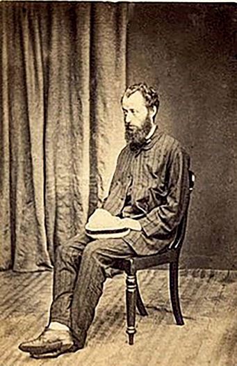
Henry Benedict Medlicott, FRS (3 August 1829 – 6 April 1905) was an Irish geologist who worked in India. He was born in Loughrea, County Galway, Ireland, the son of the Church of Ireland, Rector of Loughrea, Samuel Medlicott (1796-1858). He was educated at Trinity College, Dublin under Thomas Oldham (1816-1875) (as well as in France, Guernsey, and Dublin. He obtained a BA in 1850 with a diploma in honours in the school of Civil Engineering and an MA in 1870. He was an expert in French and was acquainted with the works of French geologists. He joined the Geological of Ireland as a general assistant in October 1851 working under Joseph Beete Jukes (1811-1869) and later with the British Geological Survey in Wiltshire before resigning to join the Geological Survey of India in March 1854.
He is credited with having suggested the name Gondwana. He used the term to describe the stratigraphy of a mostly Permian formation in India. The geologist Edward Suess noted the widespread Glossopteris fossil flora and called all the regions “Gondwana-Land” and included India, Madagascar, and Africa but not Australia. In 1888, shortly after he retired from public service, he was awarded the Wollaston Medal by the Council of Geological Society. From this date, he resided for the most part at Clifton, near Bristol, where he died at the age of 76.
In 1879, H. B. Medlicott and W. T. Blanford published a Manual of the Geology of India, chiefly compiled from the observations of the Geological Survey. The second edition was revised and largely rewritten by R. D. Oldham, Superintendent, Geological Survey of India. The abridgement of significant geological information extracted from this manual could be described as follows: -
Volcanoes
The Indian empire can boast of one volcano, which is at present dormant but has been in active eruption within the century. Barren island in the Bay of Bengal is not only a perfect model of a volcano but is classical in the history of geological controversy. It has been repeatedly referred to and described by geological writers, but the earlier references were all more or less inaccurate, and it is only within the last few years that a careful description of it has been given by Mr F. R. Mallet.
Barren Island
The volcano of Barren Island has an irregularly circular from about two miles in diameter, composed of an outer rim, rising to a height of 700 to 1,000 feet above the sea and surrounding a slightly elliptical amphitheatre, whose larger axis runs north-east and south-west with a length of 9 furlongs. From the centre of this a cone of remarkably regular rise to a height of 1,015 feet above the sea. The depression, where the slope of this cone and the inner slope of the amphitheatre meet, has a maximum elevation of 300 feet above the sea, and is almost entirely occupied by three distinct lava streams. In 1789, when Blair saw the island, the sea did not penetrate the amphitheatre, which had all been filled up to above sea level. The volcano was then in active eruption, throwing out blocks and scoria, and it may be that it had been visited at some earlier period, before the hollow was completely filled up, and that the only record left of this visit is to be found in the erroneous description which was at one time current in text-books.
At the time of Blair’s visit, there appears to have been no lava stream in the gap where the outer rim is breached, but in 1832 the lava was there and still hot that the water in contact with it was boiling. Since that period the flow was cooled down and the temperature of the water which percolates beneath the lava and issues as a spring on the seashore has steadily diminished at each visit, till it was no more than 110°F in 1886. It seems certain, therefore, that this lava flow was poured out later than 1789 and probably within the present century.
Nacondam Island
Seventy-five miles northnorth-east of Barren Island lies the island of Narcondam, indubitably of volcanic origin like the former, but composed almost, if not quite, entirely of hornblende andesite lava with little or no volcanic ash. It is not certain whether this volcano ever had a crater, as it may have been of the so-called endogenous type, formed by the quiet extrusion of lavas unaccompanied by any crater-forming materials. The complete obliteration of the crater, if there ever was one, is in itself an indication of the period for which the volcano has been extinct, and in any case, the deep ravines, with which its sides are scored, are an equally eloquent testimony of the time during which subaerial denudation has been uninterruptedly at work so that this volcano has probably been longer extinct than either of the two that follow.
Puppa (Popa) Volcano
About 50 miles north-northwest of Yenangyaung and 25 to 30 miles east-south-east of Pagan, both large towns on the Irawadi, the extinct volcano of Puppa (Popa) rises to a height of about 3,000 feet above the undulating country composed of Pliocene sands and gravels. The mountain has preserved its original form to some extent, but the crater has been greatly broken down by denudation, and the rim completely cut away at one point, where the drainage from the interior has made itself a means of exit. The peak consists of breccia, but lava flows, mostly trachytic, from the lower slopes and the surface around the base of the volcano. Among these flows are some very beautiful porphyries with crystals of pyroxene.
The horizontal beds of gravel and sand around the base of the volcano contain fossil wood and ferruginous concretions and apparently belong to the Pliocene fossil wood group. They are capped by the lava flows, contain pumice and volcanic fragments, and, in one place, a bed of ash breccia was found interstratify with them. It appears highly probable, therefore, that the volcano was active in Pliocene times, but it may have continued to emit lava and scoria at a later period.
Mud volcanoes
Associated with true volcanoes in name at least, even if, as is held by many geologists, in nothing else than a name, are mud volcanoes, of which two principal groups are known, in Burma on the east, and Baluchistan on the west, of India, respectively.
Of the Burman ones, the best known are those of Minbu on the Irawadi and those of the islands of Rami and Cheduba on the Arakan coast. A few others are reported, but they are small and isolated and consist only of temporary outbursts.
The Ramri mud volcanoes are more interesting than the others since they alone, so far as are known, are subject to paroxysmal eruptions of great violence, and from them alone stones have been ejected and flames emitted. Some of the principal phenomena may be briefly described here. There are about a dozen or rather more vents in Ramri island itself, more than half that number in Chiduba, and a few in the other neighbouring islands. Near Kyauk-Pyu in Ramri, six occur in a line, within a distance of about a mile and a half long the summit of a low broad ridge.
Many of the vents consist of truncated cones, built up of the dried mud ejected by outbursts of gas. The crater, filled with more or less liquid or viscid mud through which the gas escapes, occupies the top of the conical hillock. The majority, however, of the Ramri mud volcanoes consist of mounds, composed on the surface of angular fragments of rock and having scattered over them a few small mud cones with craters at the top, varying in height from a few inches to ten feet. When gas ceases to be omitted from a vent, the mud is rapidly washed away by rain and there remains a low mound, composed of angular fragments of rocks which were ejected together with the mud, and the repetition of a similar process accounts for the formation of the mounds.
Besides the gas and mud, a small quantity of petroleum is usually discharged from the vents. The gas consists mainly of marsh gas (light carburetted hydrogen), probably mixed with some of the more volatile hydrocarbons usually associated with petroleum. The mud is simply the grey shale or clay of the Tertiary rocks, mixed with water containing some salt in solution.
Gneissose Granite
Gneissose rocks are largely developed in the hill ranges which run southwards from the eastern termination of the Himalayas to the east of Burma and Tenasserim, but very little is known of their constitution. More or less granitoid gneiss, hornblendic gneiss, crystalline limestone, quartzite, and schists of various kinds are found. In many places, the gneiss becomes true granite, and much of the area is occupied by a rock that has been described by various observers as an eruptive granite. These gneissic formations are known to be metalliferous in several places. Tin occurs in abundance in Tenasserim and the Malay Peninsula, lead and silver mines- one of them at least, the famous Bauduen-gyee (Bawdwin Gyi), of very large dimensions and highly productive- exist in the Shan States north-east of Ava, while the valuable and productive ruby mines of Mogouk (Mogok) and the less important ones near the capital are situated in the same series of metamorphic rocks.
Carboniferous of Tenasserim
In Tenasserim the only other region where marine deposits of the Carboniferous age are known to exist, there is a great accumulation of pseudo-porphyritic sedimentary beds known as the Mergui Group, whose principal feature is derived from embedded fragments of feldspar. The rock in its normal form is earthy, but highly indurated, passing into slaty masses without the conspicuous feldspar fragments on the one hand, and on the other into grits and conglomerates. Resting on these grits, are dark-coloured earthy beds, finely laminated, with hard quartzose grits. They have only been noticed hitherto near Mergui, and nothing is known of their relations.
The beds of the last group in the Tenasserim valley are succeeded by the Maulmain groups of hard sandstones, often in thin and massive layers, with thin earthly partings, sometimes in a fine lamina, the prevailing colour is a reddish tint, and some of the layers are calcareous. Some of the more soft and earthy beds contain marine fossils. Over these sandstones occur grey shale beds, also sometimes calcareous and fossiliferous, with occasional beds of dark sandstone, then come 150 to 200 feet of fine soft sandstone, thinly bedded, with grey and pinkish shaly layers intercalated and upon these again, hard thick limestone. The fossils found appeared to be of Carboniferous age, Spirifer and Productus being the commonest forms, but the species have not been determined, and it is rare to obtain specimens in a state suitable for identification.
The thickness of these beds is estimated at about 5,000 feet, exclusive of the limestone, which is itself 1,100 feet thick near Maulmain. Near Maulmain the limestone is extremely conspicuous, and forms large hills and ranges, extending far to the south-south-east up the valley of the Attaran and Zami. The same rock occurs east of the Salwin, but does not extend far into Martaban, and is wanting in the Sittaung valley. Farther up the Salwin, however, in Karen-ni, and elsewhere beyond the British frontier, large tracts of limestone occur, probably belonging to the Carboniferous series. Limestone is said to abound in the Mergui archipelago, and may very probably be, in parts at least, identical to that found near Maulmain.
Rocks of the Arakan Yoma
In the Arakan range neither is the case, the rocks of the main range consist of rather hard sandstones and shales, greatly squeezed, contorted, and broken, traversed by numerous small veins of quartz, often slaty, and sometimes schistose, but there is a marked, deficiency of any conspicuous strata. The few bands of limestone which occur are thin, isolated, and as a rule unfossiliferous. The rocks on the western, or Arakan, side of the range seem, on the whole, less altered than those on the eastern, or Pegu, slope, and unaltered nummulitic rocks appear, on both sides throughout a great part of the area, although not continuously on the outer spurs.
The crushed, hardened, and somewhat altered rocks of the Arakan Yoma were originally separated by Mr Theobald from the newer-looking nummulitic under the name of axials and considered as comprising the oldest Tertiary beds and their immediate predecessors in the series. Although there is a wellmarked difference between the nummulitic beds and the axils, there is no distinct break between them. The remainder of the rocks forming the Arakan Yoma, excluding those of Cretaceous age, are either unfossiliferous or the few organisms which have been detected, mostly the indistinct remains of plants and Mollusca, are insufficient to afford any trustworthy indication of age. They have been classed by Mr Theobald as Negrais rocks, the name being derived from Cape Negrais, the southwestern point of Pegu, and the extreme southern termination of the Arakan Yoma.
Irawadi Delta
Compared with the Gangetic and Indus deltas, those of the Irawadi and other Burmese rivers convey an idea of imperfection and backwardness, as though the latter were of more modern growth than the former, and had made less progress towards the formation of a great fertile plain. The Salwin cannot be said to have any delta at all, and in the Irawadi delta, elevated tracts, both of rock and of the older alluvium deposits, occur in the neighbourhood of the sea. Considering the size of the river, the Sittaung delta, if the alluvial plain extending northward beyond Taung-Ngu (Tauggoo) is included, is proportionally more extensive than that of the Irawadi, but still, the broad Gulf of Martaban extends into the very mouth of the Sittaung river.
The Irawadi delta extends from the Rangoon River to the Bassein river, and the head of the delta may be placed near Myanaung. The first important distributary -that forms the head of the Bassein river- leaves the main river a little above Henzada, but water overflows in floods some miles above Myanaung, and finds its way to the sea by the Myit-Ma-Kha Khyaung, the origin of the Rangoon River. The alluvial plain and delta of the lower Irawadi consist mainly of clay very similar to that found in the Gangetic plain, but containing much less lime, and consequently poor in Kankar. The colour is generally yellowish brown, sometimes reddish, owing to the presence of peroxide of iron. The proportion of sand varies and is greater on the whole than in the Gangetic alluvium. A few thin layers of sand occur interstratified with the clay, and a band of dark blue or carbonaceous clay, a few inches in thickness, has been noticed in several localities.
References:
1. Wikipedia
2. H. B. Medlicott and W. T. Blanford.1879: A Manual of the Geology of India


