By THAN HTUN ( MYANMAR GEOSCIENCES SOCIETY )
UNESCO Global Geoparks are single, unified geographical areas where sites and landscapes of international geological significance are managed with a holistic concept of protection, education, and sustainable development. A UNESCO Global Geopark comprises a number of geological heritage sites of special scientific importance, rarity, or beauty. These features are representative of a region’s geological history and the events and processes that formed it. It must also include important natural, historic, cultural tangible, and intangible heritage sites.
A UNESCO Global Geopark must have a geological heritage of international significance which is, during the evaluation process, assessed by geoscientific experts, from the International Union of Geosciences (IUGS). It is based on the international peer-reviewed, published research conducted on the geological sites within the area. The experts make a globally comparative assessment to determine whether the geological sites constitute international value following a fixed set of criteria and questions.
The establishment of a UNESCO Global Geopark stimulates the creation of innovative local enterprises, small businesses, sustainable tourism activities and businesses, geotrails, and new jobs by generating new sources of revenue (e.g. geotourism, geoproducts) while protecting the geo-resources.
A quick check to verify if an area has got all the important assets to prepare an application for UGGp designation is the Self-evaluation checklist and its explanatory notes, developed by the UGGp Council. This should be the first thing to do for anybody who has the idea to prepare an application dossier for UNESCO.
’s Executive Board approved the designation of eight new UNESCO Global Geoparks bringing the number of sites participating in the Global Geoparks Network to 177 in 46 countries. Two new countries, Luxembourg and Sweden, this year join the Global Network with the designation of their first geoparks. With these eight new designations, the Network now covers a worldwide surface area of 370,662 square kilometres, comparable to the area of Japan. The newly designated UNESCO Global Geoparks are:
•Seridó UNESCO Global Geopark, Brazil
•Southern Canyons Pathways UNESCO Global Geopark, Brazil
•Salpausselkä UNESCO Global Geopark, Finland
•Ries UNESCO Global Geopark, Germany
•Kefalonia-Ithaca UNESCO Global Geopark, Greece
•Mëllerdall UNESCO Global Geopark, Luxembourg
• Buzău Land UNESCO Global Geopark, Romania
•Platåbergens UNESCO Global Geopark, Sweden
•Seridó UNESCO Global Geopark, Brazil
The Seridó UNESCO Global Geopark covers an area of 2,800 km² in the semi-arid northeast of Brazil. It is home to more than 120,000 inhabitants, including communities like the Quilombolas, who keep alive the memory of their enslaved ancestors from Africa to preserve their culture through traditional practices, museums and cultural centres. The geopark bears testimony to the last 600 million years of the Earth’s history and shelters one of South America’s largest scheelite mineralizations, an important tungsten ore, as well as basalt flows that stem from volcanic activity during the Mesozoic and Cenozoic Eras. This geodiversity determines to a large extent the region’s unique biodiversity, especially characterized by the Caatinga (‘white forest’ in the Tupi language), an ecoregion marked by specific subtropical flora. The Caatinga is the only exclusively Brazilian biome, which means that much of its biological heritage cannot be found anywhere else on the planet.
Southern Canyons Pathways UNESCO Global Geopark, Brazil
The Caminhos dos Cânions do Sul UNESCO Global Geopark in southern Brazil covers an area of 2,830.8 km² and is home to 74,120 inhabitants. It is characterized by Atlantic Forests, one of the planet’s richest ecosystems in terms of biodiversity. The area’s pre-Colombian inhabitants used to shelter in paleoburrows (underground cavities excavated by extinct paleo-vertebrate megafauna like the giant ground sloth) whose numerous vestiges are still visible in the geopark. The site moreover features the most impressive canyons in South America, formed by the unique geomorphological processes that the continent underwent during the breakup of the Gondwana supercontinent some 180 million years ago.
Salpausselkä UNESCO Global Geopark, Finland
Home to around 177,000 inhabitants, the Salpausselkä UNESCO Global Geopark is located in southern Finland, in the southernmost part of the Finnish Lakeland, covering an area of 4,506 km². Around 21 per cent of the geopark is covered by water and over half by forests. The hundreds of lakes in the geopark are a central feature of the landscape, along with the long, distinct Salpausselkä ridges. Extending over more than 600 km across southern Finland, the ridges consist of sediments deposited by glaciers. They bear witness to climate change, specifically to the Younger Dryas, the cool period that lasted roughly from 12,900 to 11,600 years ago, and disrupted the Northern Hemisphere’s warming trend at the end of the Pleistocene Epoch (2.6 million to 11,700 years ago). Studied since the 19th century, these ridges constitute Finland’s best-known geological heritage set in a landscape formed by melting glaciers that created glaciofluvial landforms and rock formations that store an abundance of groundwater and provide the region with naturally high-quality drinking water.
Ries UNESCO Global Geopark, Germany
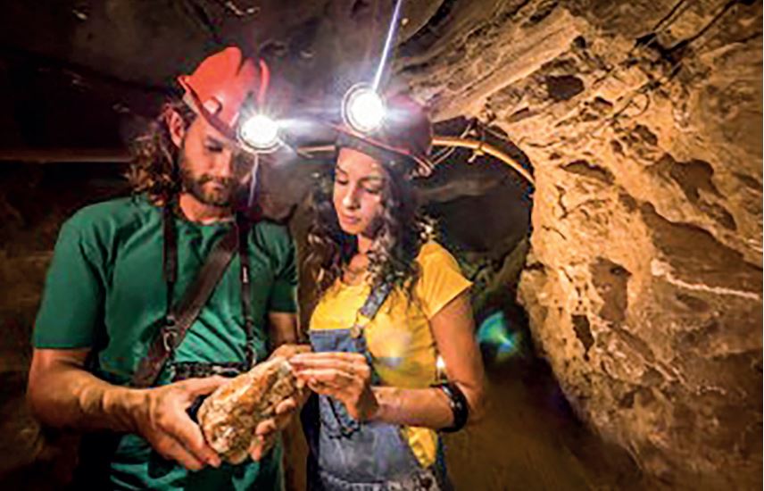
Most of the Ries UNESCO Global Geopark area lies in the state of Bavaria, with a smaller part in the state of Baden-Wür temberg comprising the Ries Crater, situated between the Swabian and Franconian Alb in southern Germany. The geopark covers an area of 1,749 km2 with around 162,500 inhabitants. Some 15 million years ago, a meteorite collided with Earth in this very place, leaving an impact crater that is the best-preserved meteorite crater in Europe and the most intensively studied impact structure among the nearly 200 known craters worldwide. Visitors can explore the Nördlinger Ries impact crater and learn about its geology and history by following nature trails which take hikers to scenic outlooks, on their own or on guided tours. Information centres and school programmes are also available. The geopark provides an intriguing insight into the Earth’s history through its unique natural landscape, and cultural and culinary history.
Kefalonia-Ithaca UNESCO Global Geopark, Greece
In Western Greece, the Kefalonia – Ithaca UNESCO Global Geopark is an island complex be longing to the Heptanese (from the Greek for seven, the number of principal Ionic islands). Kefalonia occupies an area of 773 km² and is home to 35,801 inhabitants and Ithaca’s 117 km² are inhabited by3,084 people. The geopark is rich in geosites of karstic origin such as caves, sinkholes, and underground streams, all of which are scattered throughout the islands telling of a geological history that goes back more than 250 million years. Both islands are located very close to a mountain chain shaped like an arc (the Hellenic arc) formed by the subduction of the African Plate under the Eurasian Plate. It is the most tectonically active region in Europe. The geopark also has a literary significance as Kefalos and Ithaca are named in the Odyssey as the homeland of Ulysses, the hero of Homer’s epic poem. The geopark is also home to prehistoric Hellenistic and Roman monuments, medieval castles, Byzantine and post-Byzantine monasteries, traditional settlements, windmills, bridges, and lighthouses, a rich cultural heritage scattered over the area’s extraordinary geological features.
Mëllerdall UNESCO Global Geopark, Luxembourg
In Eastern Luxembourg, the rural Mëllerdall UNESCO Global Geopark covers 256 km² with a population of about 25,500 inhabitants. The geopark is situated in the centre of the Trier-Luxembourg Basin, which extends from the Paris Basin to the Rhenish Massif. It features the Luxembourg Sandstone Formation which reaches a thickness of up to 100 meters and dates from the Lower Liassic age (205 to 180 million years ago). It forms one of the most spectacular sandstone landscapes in Western Europe and has been a tourist attraction since the late 19th century. Today, the region can be explored by following a dense network of well-signposted hiking trails, including the 112 kilometre-long Mullerthal Trail, which has won the Leading Quality Trails – Best of Europe award.
Buzău Land UNESCO Global Geopark, Romania
In the Carpathian Bend Area in Romania, the hilly and mountainous territory of the Buzău Land UNESCO Global Geopark covers 1,036 km² and is home to some 45,000 inhabitants. Several tectonic plates collided in the region, creating a very complex fold and thrust mountain range which was later eroded by glacial action. One of the most geodynamically active areas in Europe, the geopark exhibits 40 million years of geological history. Over this period, its tectonic movements pushed up mountains and transformed a deep-sea environment into a terrestrial one. Fossils of marine species, terrestrial vegetation, mammals, and birds dating from the last glaciation have been well-preserved in the Carpathians. Many fossils of beetles, spiders, crustaceans, reptiles, and other species are conserved in amber, a fossilized resin. Some of the longest and deepest salt caves in the world are also found here, remnants of large deposits of salt and gypsum formed by the evaporation of shallow enclosed bodies of water. This rich geodiversity has influenced a unique cultural heritage with local legends in which mud volcanoes become dragons, mud boilers are traps made by giants to catch cattle, and the future can be predicted by looking through a lens of amber.
Platåbergens UNESCO Global Geopark, Sweden
In West Sweden, the Platåbergens UNESCO Global Geopark covers an area of 3,690 km2 and is home to 289,198 inhabitants. It presents a unique landscape of 15 flat-topped Table Mountains, platåbergen in Swedish, after which the site is named. These mountains were shaped by erosion during the last Ice Age 115,000 years ago. The area also covers the Västgöta Plain with its shallow floodplain lakes, undulating ridges, and well-preserved cultural landscapes. Some of Sweden’s most interesting historical discoveries have been made in this area where museums preserve numerous vestiges that bear witness to inhabitants’ use of the local stone over the millennia: from megalithic graves (5,300-4,700 BCE) to the first known stone church in Sweden, built by Christian Vikings in the early 11th century.
In Myanmar, since 2016, the Forest Department and Department of Geological Survey and Mineral Exploration under the Ministry of Natural Resources and Environmental Conservation and Myanmar Geosciences Society have been striving to establish National Geopark in the Mount Popa region. We look forward to seeing many National Geoparks and UNESCO Global Geoparks in Myanmar in the foreseeable future.
Reference: International Geoscience and Geoparks Programme (IGGP)


