Tropical storm Mitag is bringing heavy localized rains mainly to western Japan.
The Meteorological Agency says Mitag is currently near the Korean Peninsula. Warm and humid air flowing toward the storm is making atmospheric conditions unstable.
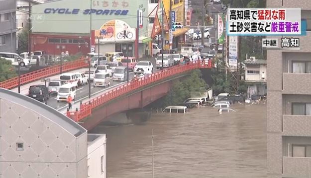
Weather officials say radar analysis indicates Susaki, Tosa and Kochi cities in Kochi Prefecture each received about 120 millimeters of rain in one hour on Thursday morning.
Mitag is expected to become a low pressure system, move over the Sea of Japan and approach northern Japan on Friday or later.
Unstable air conditions are expected to continue on the Pacific side of western and eastern Japan through Friday.
Eighty millimeters of rain per hour may fall in some areas with lightning on Thursday. Heavy rain is also forecast for northern Japan for Friday.
Strong winds and rough seas are expected in the northern Kyushu region through Thursday noon and in Hokuriku and Tohoku on Friday.
Weather officials are warning of mudslides, flooding in low-lying areas and swollen rivers. There is also a risk of violent winds and high waves on the Sea of Japan side.
nhk


