14 July
Over 10,000 residents evacuated in Myitkyina
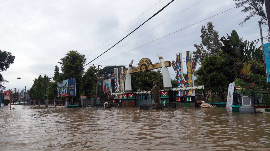
The Ayeyawady River passed the danger level on 12 July as river water flowed into low-lying areas in Myikyina, forcing over 10,000 residents to abandon their homes for temporary shelters yesterday.
The water level reached some 30 cm above its danger level on 12 July, following a torrential rainfall.
A flash flood affected over 2,000 households from wards in Myitkyina.
Local authorities set up 26 temporary shelters at religious buildings and transported flood victims to these shelters, and provided them with aid.
Flood in Sagaing
As the water levels of the Chindwin River and the Ayeyawady River are rising, some families in upper areas of Sagaing Region have also moved to temporary shelters.
About 45 people from 13 households in Kamti Township moved to a temporary shelter to escape the rising Chindwin River, along with 55 people from nine households in Katha, as the water from the rising Ayeyawady River flowed into their areas.
“The two rivers have not yet reached the danger level in Kamti and Katha towns. We have provided cash for food to the victims and are raising alerts about flash floods in the area,” said U Sa Willy Frank, Head of the Sagaing Region Natural Disasters Management Department.
Torrential rain causes havoc in Hsawlaw, Myitkyina District
A torrential rainfall from 8 to 10 July caused landslides and flash floods in rivers, which destroyed bridges, causing havoc in Hsawlaw Township, Myitkyina District.
“The flash flood in the Maykha River caused erosion and landslides. Out of 700 acres of land to be reclaimed, about 200 acres were eroded by the flood,” said Daw Khaw Mar Oo, Pyithu Hluttaw Representative from the Hsawlaw Township Constituency-2.
Similarly, landslides were reported in villages and one bridge was washed away by the flood waters. —Kachin State IPRD (Translated by Kyaw Zin Lin)


