9 June
THE Kacchapanadi, better known as the Kaladan river, is the most useful and long-est river in Rakhine State. It rises in the over 8000-foot high Lushai mountain in the northern Chin State. It first courses down along the border between Myanmar and India and then joins the Boinu river rushing down from the south, some miles south of Falam. And, having wound its way through the northern Rakhine State for over 220 miles, it, immediately south of Sittwe, empties into the Bay of Bengal. Its estuary near Sittwe is six miles wide. It can be navigable for 150 miles from the mouth.
The Pali word ‘ Kacchapanadi’ bears the sense ‘ The river teeming with numerous rocks which are in the form of the backs of turtles’. Some people say that the river is so called, for a host of hill-locks half submerged in water at its starting point are shaped like turtles swimming about. The term’ Kaladan’ is a corruption of the Pali one’ Kulatthana’. ‘Kula’means ‘ race or lineage’ and ‘ tthana’ place.
Therefore, the word ‘Kaladan’ can be loosely interpreted as the river where the Rakhines lives’.
On the banks of the Kacchapanadi are located Sittwe, Ponnagyun, Kyauk-taw and Palawat. Sittwe, the capital of Rakhine State, lies on its western bank. It covers an area of 89.42 square miles and has a total population of 2.33 lakh. It was founded by the British in 1826 and then called ‘Akyab’ after the Arkyab stupa standing isolated on a hill-lock to the west of the town. Many tourists, foreign and local, are attract ed by the beautiful Point Beach at the southern –tip of the town. Ponnagyun on the same bank about 17 miles from Sittwe, came into being in 1905 and was known by that name, for it was inhabited by Ponnas(Brahmins)in ancient times. Its population stands .
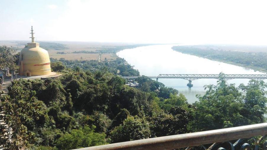
at 1.33 lakh and its area, 430.63 square miles. It is reputed for the Urit-daw Pagoda on the Urit-daw mountain across a small creek from it. Kyauk-taw, established in 1910, is 75 miles from the mouth of the Kacchapanadi river. It is so called after the Kyauk-taw stupa on the Selagiri mountain on the other bank. It is famous for the Maha Myat Muni Buddha image be-lieved to be cast in the presence of the Lord Buddha during his visit to Dhan-navati in the year 123 ME. Kyauktaw extends a total area of 675.7 square miles and has a total population of 2.11 lakh. Palawat, on its western bank , is over 100 miles from the mouth of the Kacchapanadi river. It covers an area of 1366 square miles and is peopled by 96899 souls. Although it is today in Chin State, it had been included in Rakhine State before 1826.
The Kaladan valley is formed by the deposition of the sediments carried by the tributaries of the La-ymyo river a few miles to its east. It starts a little distance up Kyauktaw and stretches as far south as Sittwe, as far east as Mrauk-U, Minbya and Myebon and as far west as the base of the Be-ngar-yar Taung (Mountain of 500 Ducks) in Ponnagyun township. Roughly speakingly, it covers a total area of 1400 square miles, measuring 55 miles from the north to the south and 25 miles from the east to the west. It is very fertile and the largest valley in the Rakhine coastal region. Therefore, ancient Rakhine kings established ancient cities such as Dhannavati, Vesali and Mrauk U in this valley. Today, Sittwe, Kyauktaw, Mrauk U, Ponnagyun and Pauktaw are located there. The Kaladan valley is commonly called ‘ Sittwe Valley’ due to the prosperity of Sittwe. The Kala-dan river-valley development project was launched in 1999. It aimed to build the motor-road from Me-zo-ran State in India to Sittwe through Palawat, to dredge the sediments deposited in the shallow areas of the Kaladan river, to build ships and wharfs and to upgrade the Sittwe-port.
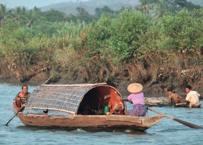
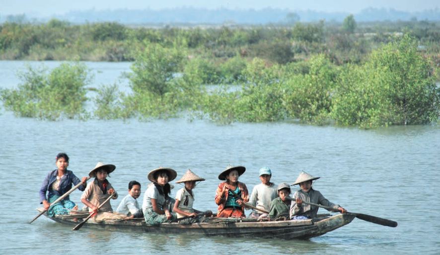
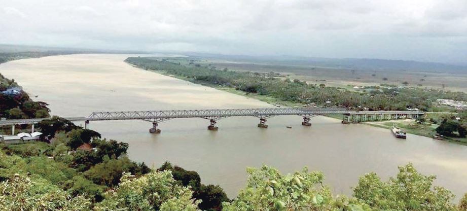
The Kacchapanadi is pleasant with its both banks covered with vast greenery fields, lush forests and wood-ed mountains crowned with ancient Pagodas. The Urit-daw mountain near Ponnagyun, the Selagiri mountain on the other bank of Kyauktaw and the Be-ngar-yar Taung ( Mountain of 500 Ducks), immediately west of the Yoe creek, a major tributary of the Kacchapanadi river, are attractive tourist destinations on the river . The skull-relic of the Buddha is enshrined in the Urit-daw stupa at the prophecy of the Buddha. It is datable back to the 3rd century B.C. When Buddha came to Dhannavati city in response to the mental invitation of King Candasuri-ya in the 123 M.E , he took a stand at the top of the Selagiri mountain . To commomerate this great event, the Kyauk-taw pagoda was later built with the enshrinement of the spine-relic of the Buddha at that very spot. The Be-ngar-yar mountain is figuratively called ‘ Mt. Fuji of the Rakhine State’ for the breath-taking beauty it offers. The Kacchapanadi bridge near Kyauk-taw, the first river-crossing bridge in Rakhine State opened in 2010, is also a beautiful spot on the Kacchapanadi river.
In short, the Kacchapanadi is a very beautiful river endowed with scenic spots and diverse bio-species. Its fertile valley yields a good supply of crops and cereals. It is therefore called ‘Granary of Rakhine State’. Moreover, as it housed ancient Rakhine cities, it can be said to be the cradle of Rakhine civilization. It is thought by the author that if the course of the Kacchapanadi and its valley can be developed by the Un-ion Government, this will contribute much to the development of the entire Rakhine State.
Dr. Saw Mra Aung